Rising waters: creating a risk culture
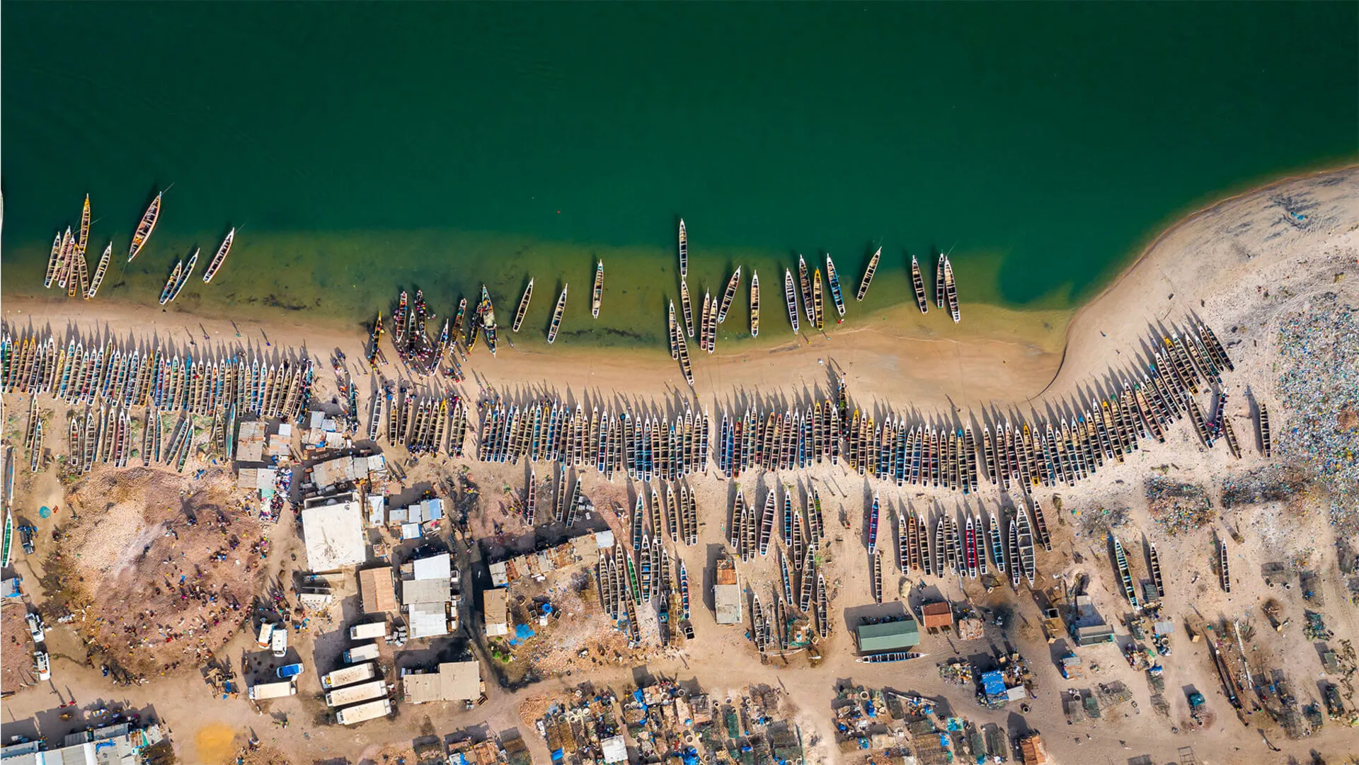
Djiffer fishing village, Saloum Delta (Senegal)
With many countries facing accelerating sea level rise, what strategies should be adopted to protect coastal zones from the risks of erosion, submersion and saline intrusion? PB Magazine seeks answers from a scientist and an expert in water management in the Netherlands, a country that has had to manage flood risk for centuries.

Rafael Almar
Research Director at the Research Institute for Development (IRD), physicist oceanographer specialising in the coast at Study laboratory in Space Geophysics and Oceanography (LEGOS).

Yann Friocourt
Adviser for water management modelling tools at the Rijkswaterstaat, an agency of the Dutch Ministry of Infrastructure and Water.
What is causing sea level rises?
Rafael Almar: Sea levels have gone up and down for millennia. However, it is currently increasing and at a rate that is accelerating compared to the pre-industrial period, going from 1.4mm per year on average in the 20th century to more than 3mm per year today. A consequence of global warming, this phenomenon is due to the combined effects of the rise in the temperature of the seas and oceans — which causes them to “swell” (thermal expansion) — and also the melting of glaciers and the polar caps of the Arctic and Antarctica.
According to estimates from the IPCC (Intergovernmental Panel on Climate Change), we can expect sea levels to rise by around one metre by 2100, unless we significantly reduce our greenhouse gas (GHG) emissions. This increase will have a major impact on coastal areas, particularly in terms of erosion (retreating coastlines), submersion and saline intrusion.
To this inevitable rise in water levels, added vulnerabilities linked to human activities and not just to global climate change, are now being added. Thus, coastal erosion is currently mainly due to massive losses of sediment caused by infrastructure, notably dams on rivers. While subsidence (land subsidence) is linked to human activities such as urbanisation and groundwater pumping. This is what happened in Jakarta, the capital of Indonesia, which has sunk 6 metres below sea level over the last few decades.
How does the phenomenon manifest itself in the Netherlands, where 26% of the territory is already below mean sea level?
Yann Friocourt: Given the geographical location of the country, this phenomenon has been monitored for a long time. Over the last thirty years, sea levels have risen by 3mm per year, and this rise seems to have been accelerating over the past fifteen years. Although episodes of drought and heavy precipitation are attracting the most attention today, it is increasingly clear that the real issue to be managed in the future will be rising waters. Since 2011, the government has implemented the Delta programme1 to anticipate the effects of climate change on water management. In November 2023, the meteorological institute (KNMI) published forecasts which projected the level of the North Sea rising by one metre by 2100, depending on changes in global GHG emissions and the accelerating melting of ice.
The government also launched a major research programme in 2019 aimed at forecasting beyond 2100, in order to understand the challenges that rises in sea level of 1, 2, 3 and 5 metres would pose. To what extent would current water control strategies still be sustainable? How should they be modified? It is important to ask fundamental questions as early as possible, so as to anticipate choices that will have significant societal and economic impacts.
Which areas are most affected around the world?
R. A.: The delta regions of Southeast Asia, the island states of the Pacific, the sandy coast of West Africa, where “megacities” are developing, are areas under particular threat. The coastlines are not fixed but in perpetual movement and this natural variability has been insufficiently taken into account, as evidenced by recent urbanisation close to the shores across all continents.
In France, for example, the seaside resorts built in the 1960s on the Occitan or Atlantic coast were built along the beaches even though historically the towns were several kilometres from the sea, such as Lacanau and Biscarrosse.
We underestimated the risks. However, the combined effect of rising sea levels, strong waves and heavy rain can cause significant damage as we saw with Storm Xynthia in 2010. In West Africa, recent studies show that the main risk factor for coastal flooding is rapid human development of the coastline, with the construction of dams and deep water ports, together with concreting over of the coastline, drilling and rampant urbanisation. And all this in addition to the rise in ocean levels2, which will not make matters any easier to deal with.
The natural vulnerability of the coastlines has been obscured.
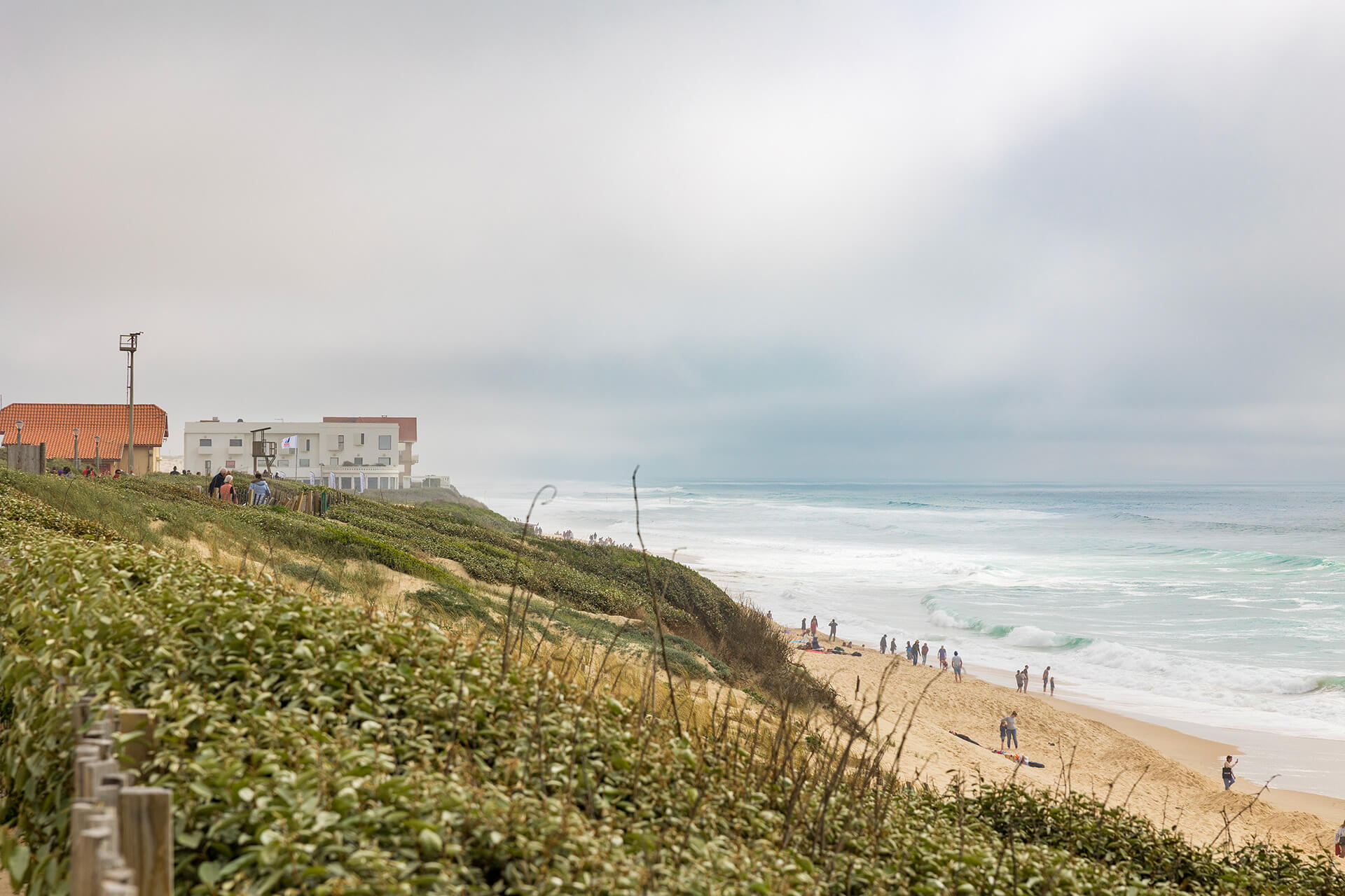
Biscarosse beach, Nouvelle Aquitaine (France)
What are the solutions to anticipating and reducing risks to the coastlines?
R. A.: We now have observation methods that allow us to make increasingly precise forecasts, helping anticipate risks and deploying adaptive strategies. For example, thanks to the analysis of almost 40 years of satellite data, we have been able to study the significant global influence of the climatic and oceanographic phenomenon El Niño on erosion or enlargement of certain coastlines around the world3. This study provides a framework for making forecasts up to six-months out, supplying very valuable information for both public and private economic stakeholders. West African countries are joining forces in the monitoring of coastlines through programmes such as the West African Coastal Regional Observatory (ORLOA) or the West African Coastal Management Programme (WACA), as supported by the World Bank4. A network of surveillance cameras installed in five countries (Senegal, Ivory Coast, Ghana, Benin, Cameroon) transmits complementary information in addition to that collected on the ground and by satellites. As another illustration, there is the region-scale project implementing vulnerability tools and indicators with the Space for Climate Observatory (SCO) programme5. These are important initiatives, helping to better understand and predict the risks of erosion and submersion and develop early warning systems.
Is Dutch society as a whole tackling this subject and what are the expected economic impacts?
Y. F.: The question of water control and the risk of flooding is deeply anchored in our culture. The first regional water management organisations, the wateringues, date back to the 13th century! Citizens have confidence in this model because it has proven itself. Its robustness is due to a very structured organisation at the regional and national levels, and a clear sharing of responsibilities and financial resources dedicated to infrastructure maintenance. But this should not prevent us from undertaking a social debate on what might happen with the acceleration of rising water levels and on possible options for the future. At the economic level, one of the first impacts of rising sea levels will be concerns about the supply of fresh water as this aggravates the problem of soil salinization. Agriculture, and in particular key production and export sectors such as plants and flowers which require large amounts of soft water, or fruits and vegetables, will be impacted. Structural choices prioritising certain water-uses, crop-types, and land-use planning will be necessary over the long term. More generally, water management costs will increase, because it will be necessary to increase pumping capacities, which are very energy-intensive, to help regulate water levels, particularly in low-lying regions.
What possible strategies are there to strengthen the protection and resilience of coastal areas?
R. A.: I would like to emphasise the importance of collectively developing a culture of risk in the coastal zones. Informing populations is crucial for building shared strategies, in the short and long terms. Technical protective solutions, such as riprap or dikes, are effective in the short term for managing emergencies. In Saint-Louis, Senegal for example, the French Development Agency financed the construction of a riprap to protect the fishing district of Guet Ndar, threatened with submersion.
But we need to question the utility of this type of solution over the long term and opt for more flexible management methods, favouring a more adaptive approach. Strategies based on nature and on strengthening ecosystems, such as the maintenance and re-vegetation of dunes, coastal marshes or even the planting of mangroves, offer real possibilities for protecting coastlines.
That being said, it remains to be seen whether all coasts should be protected. In some parts of the world, there is already no other choice but to move local populations. Withdrawal strategies will be necessary in the long term for other vulnerable and/or sparsely populated territories. But this requires being ready to support communities and take socio-economic factors into account on the one hand, and promoting solidarity between countries at a regional and international level, on the other, as shown by the example of West Africa.
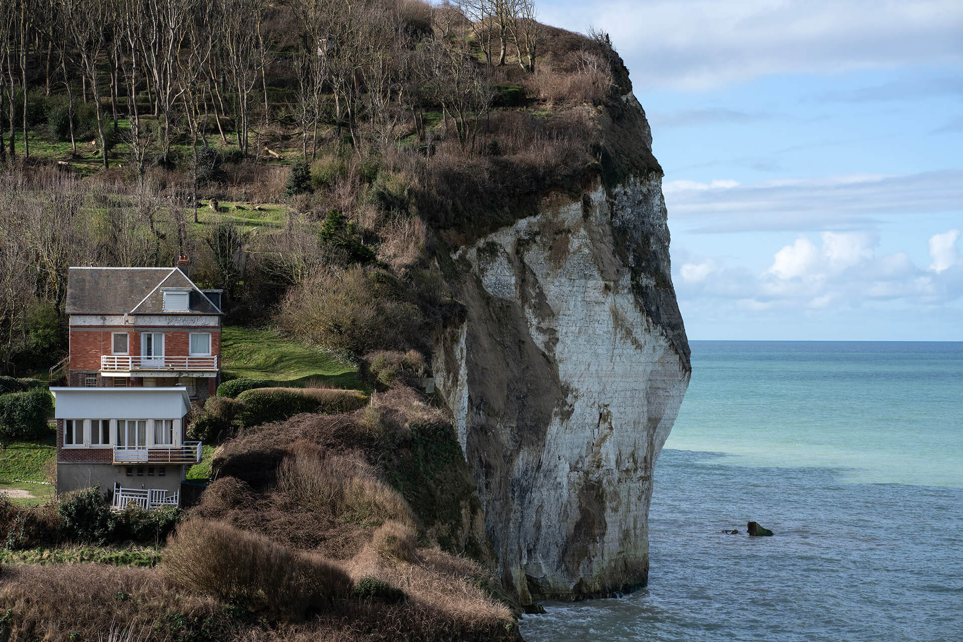
Cliff at Saint-Pierre-en-Port, Normandy (France)
Faced with the challenge of rising water levels, how will the Dutch strategy evolve?
Y. F.: The current strategy is based on the following priorities: protecting the country from flooding, providing good quality water for agriculture and domestic consumption, and facilitating river navigation. Research work shows that the solutions deployed to deal with flooding — dikes, anti-storm dams, retention basins, sand replenishment of beaches and dunes, etc. — remain effective up to a rise in sea level of 5 metres. We are now also assessing the problems created by certain solutions adopted in the past. Thus subsidence (with soil subsidence of 1 to 2cm per year), which is caused by the pumping of water and the drying out of peaty soils carried out for agricultural purposes, will continue in parallel with rising sea levels. Over the past two decades, approaches to adapting to and living with nature have gained ground. This is the case for the “More space for the river” programme, as well as the maintenance of the coastal dune barrier, which constitutes a natural protection against flooding. Numerous studies are being carried out, such as water storage in natural areas or retention basins in urban areas.
In fact, the debate on future options tends to result in two different, competing visions. That of engineers, who defend the potential of technical solutions with the building of dikes, the construction of artificial islands and retention basins, and that of geographers, who envisage a gradual withdrawal from the coast and the abandonment of certain very vulnerable regions. This last option relies on such an approach being acceptable for populations accustomed for perhaps centuries to protecting their lands against the sea. It is likely that the Dutch model, based on compromise, will deploy varying strategies, depending on the specificities of each region.
Can this Dutch model catch on around the world?
Y. F.: These factors will no doubt fuel a social debate on the decisions that are sometimes difficult to make. In this context, the Netherlands will also have to learn lessons from experiments carried out by other countries, while taking into account the local environment and acting in a typically Dutch, decentralised manner. The interest of the Dutch model – the “polder model” – lies in this ability to allow all stakeholders to participate in the decision-making process, achieving shared water management measures. This process is certainly long but it encourages us to anticipate and proceed in stages. The principle of the adaptation paths of the Delta programme is inspired by this: measures are implemented gradually, according to need, and evaluated and reinforced according to their effectiveness. Involving the entire population at each stage and obtaining their active support is essential to carrying out this necessary adaptation to rising water levels.
Look further

TWO REPORTS
Rising sea levels: Approaches from OECD countries facing coastal risks.
OECD, 2019
Adapting coastal cities and territories to rising sea levels in West Africa: Challenges and good practices
Sea’ties regional report, Ocean & Climate Platform, 2023.

A NOVEL
Rising waters
Pierre Lieutaghi, Actes Sud, 2023
TWO SITES
History of Holland: Water
https://www.holland.com/fr/tourisme/trouvez-votre-chemin/interets/eau-histoire#chapter3
https://www.nl-waterexperience.com/
Today is already tomorrow
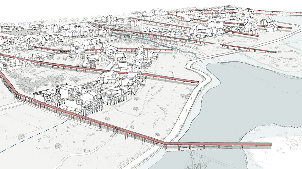
The pile strategy
If coastal architecture can be designed to be lighter, it can be dismantled in winter and moved in response to variable water levels. This is the thinking behind the “Oyat” project for the town of Frontignan. And it received first prize in the “Living on the coast tomorrow” competition, launched in 2022 by the Hérault region (France)!
The agency proposes a “refuge zone” parallel to the coastline from which walkways extend towards the sea to serve housing built on stilts, transport networks above water and also serve as a means of evacuation.
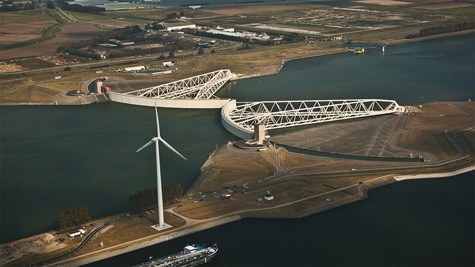
A mobile storm barrier
Some 30km from Rotterdam, the Maeslantkering protects the largest seaport in Europe. With its two steel arms, 210-metres wide and 22-metres high, this anti-storm dam, built between 1991 and 1997 and controlled by computer, closes in two hours if the water rises more than 3 metres.
It has only been closed twice since it was commissioned but could be closed more frequently in the future due to predicted sea level rises.
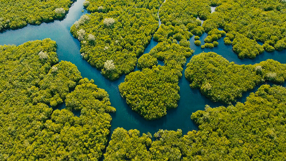
The return of the mangroves
At home between the land and the sea, mangroves can provide strong natural barriers against storms, tsunamis and floods. They reduce the height and energy of waves and wind speed locally too. Located in tropical and subtropical coastal areas, this vegetation is threatened by human activities, however.
Thankfully, like UNESCO, which works in biosphere reserves in Latin America and the Caribbean, there are initiatives in Thailand, India and Vietnam to replant mangrove forests.

Interview by
Catherine Veglio
Editorial adviser, journalist, novelist, Catherine Véglio explores the fields of economy,
innovation, science, technology and their relationships with society.
1 www.government.nl/topics/delta-programme
2 “Socioeconomic development change, rather than sea level rise, poses the main hazard for the future West African coast”, Nature Communications Earth & Environment, 15 May, 2023.
3 Influence of El Niño on the variability of global shoreline position, Nature Communications, 12 June, 2023.
4 https://www.wacaprogram.org/
5 www.spaceclimateobservatory.org/fr/waca-var
© Arno Brignon; Sarah Tulej; DR
© Ludwig Deguffroy/Getty Images; Mmariusz Prusaczyk/Getty Images
© Marie-Hélène Labat; DR; photopqr/Ouest France/Franck Dubraý; Oyats; Frans Lemmens/Getty Images; Alex Punker/Getty Images


